
An article written by Sarah McEwen, PE

In today’s world of open-source data, and artificial intelligence (AI), we as engineers must adapt and dig deeper in assessing what data we use in our designs. The saying goes “garbage in, is garbage out” and this is especially true when we start to look at the data collection phase of a project and design.
It is important to know who, what, when, why, and how the data is being used. Who collected the data? What was the intended use of the data? Why was it collected? How was it collected? When was it collected?
Who collected the data can tell you a lot about the quality and whether any quality assurance was done. How, why, when, and what was the purpose of the data being collected may lead you to see what gaps in collection you need to fill if your project purpose is different.
For example, LiDAR collected by the United States Geological Survey, because of its funding is often heavily reviewed and processed before publishing. LiDAR is typically done for large terrain collection and like other data sources, should be reviewed for limitations like resolution.

The LiDAR might be collected as a Point Cloud, then filtered into a data product bare earth Digital Elevation Model (DEM). Standard DEMs can be found from USGS at the 1-meter level. It is often collected as a direct response to a state or federal programs need, like FEMA mapping or statewide watershed programs. How and when it was collected might lead to limitations in detail. For instance, if data was collected during high water some low-lying areas might not be picked up in detail if submerged. 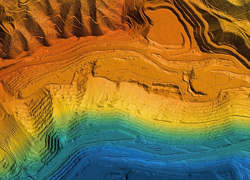
If you were looking to use LiDAR to supplement survey across a site, you need to consider all the factors above to state any limitations on your analysis, or additional post processing like collecting and applying bathymetry when reporting the results.
Every input, every data source, and every unknown accumulates our uncertainty. We all know from a practical sense, you use “best available data” but sometimes in rural areas, that data can be limited. We should strive to develop a technical approach that respects the available data, budget, and design criteria. Being sure we meet any regulatory and best practice requirements.
Sometimes depending on the phase of the project more risk and uncertainty can be tolerated. It is our duty to state our limitations, any decisions we make that play a critical role in the analysis or application of the data, and our recommendations as professionals.
So, as a helpful tool I want to share some of my go to data sources:
- Mississippi Automated Resource Information System MARIS (mississippi.edu)- a well-rounded data collection system with Mississippi specific information including transportation, elevation, political, and census data.
- FEMA Flood Map Services- A great first stop when assessing what if any FEMA flood hazards you need to consider.
- National Land Cover Database (NLCD) – landcover database for support in evaluating Manning’s N or change in development over time
- Web Soil Survey - Home (usda.gov) – provides soil data and information produced by the National Cooperative Soil Survey.
- National Map Download TNM Download v2 (nationalmap.gov) – a great catch all hub for USGS data including elevation, aerial, and hydrography.
- NOAA ATLAS 14 PF Map: Contiguous US (noaa.gov) (Note: Atlas 15 coming soon)- precipitation data
About the Author: Sarah is a graduate of Mississippi State University where she received a Bachelor of Science degree in Civil and Environmental Engineering. She is the President of the Friends of the Mississippi River Basin Model and currently works at Neel-Schaffer, Inc as Central Region Hydrology and Hydraulics Discipline Lead.
Articles by contributors are not necessarily the viewpoint or opinion of the Mississippi Board of Licensure for Professional Engineers & Surveyors.